Maui snorkel report: how to check today's conditions
How to read surf, wind, tide and water-quality reports for Maui snorkeling, which coast to choose by season, and where to go when your first choice is rough.
Some links are affiliate links: if you book or buy through them we may earn a commission at no extra cost to you. How this works.
On this page
On Maui, the same beach can be glassy at 8 am and whitecapped by noon, and a spot that is perfect in July can be dangerous in January. Learning to read a few simple reports will do more for your trip than any "top 10" list. The same method works on every Hawaiian island.
The four things to check
1. Swell direction and height. Every coast faces a different direction. A north or northwest swell hits West Maui; a south swell hits South Maui. Look at the surf forecast for each shore: under 2 feet is ideal, 2–3 feet is OK at sheltered spots, above 3–4 feet means pick another coast.
2. Wind. Maui's trade winds blow from the northeast and usually build through the day. Under 10 mph is excellent. 10–15 mph is fine early. Above 15 mph, South Maui gets choppy by late morning. Kona (southerly) winds, a few times a year, flip the pattern and make West Maui rough.
3. Brown water advisories. After heavy rain, the Hawaii Department of Health issues brown water advisories. Runoff kills visibility and can carry bacteria. Honolua Bay and Olowalu are particularly affected.
4. Tide. It matters at shallow reefs. At low tide at Olowalu or Kahekili, coral can be inches below the surface. Go at mid to high tide.
Where to find the information
- National Weather Service surf forecast for Maui: swell size and direction for each shore.
- Hawaii lifeguard surf report (hioceansafety): conditions and warnings by beach.
- A wind and buoy app: hourly wind speed and direction.
- Hawaii Department of Health clean water branch: brown water and bacteria advisories.
- Local dive and snorkel shops in Kihei and Lahaina often post daily reports.
Which coast to choose
West Maui (Kapalua to Kaanapali)
Northwest-facing coast
- Level
- 2 of 5
- Entry
- Shore
- Depth
- Varies
- Visibility
- Best in summer
- Best months
- May to September; calm winter days
- Facilities
- Varies
- Fees and permits
- Free
- What you'll see
- Honolua, Kapalua, Napili, Black Rock
How to get there
Affected by north and northwest swell in winter. Sheltered from trade winds in the morning.
20.970° N, 156.680° WDirections
South Maui (Wailea to Makena)
Southwest-facing coast
- Level
- 1 of 5
- Entry
- Shore
- Depth
- Varies
- Visibility
- Best in the morning
- Best months
- Year-round; best October to April
- Facilities
- Varies
- Fees and permits
- Free
- What you'll see
- Ulua, Makena Landing, Maluaka, Ahihi
How to get there
Sheltered from north swell but exposed to summer south swell and to strong trade winds after late morning.
20.660° N, 156.440° WDirections
Olowalu and the Pali coast
South-facing West Maui
- Level
- 2 of 5
- Entry
- Shore
- Depth
- Shallow
- Visibility
- Good when calm
- Best months
- Calm mornings
- Facilities
- None
- Fees and permits
- Free
- What you'll see
- Big shallow reef, turtles
How to get there
A good backup when both main coasts are rough, but visibility drops quickly in wind.
20.808° N, 156.618° WDirections
| Situation | Go to |
|---|---|
| Summer, light wind | West Maui: Honolua, Kapalua, Napili |
| Winter, north swell | South Maui: Ulua, Makena, Maluaka |
| Strong trades | South Maui at sunrise, or Kapalua (sheltered) |
| South swell (summer) | West Maui |
| Both coasts rough | Book a boat: captains find the calmest site |
When a boat trip is the better choice
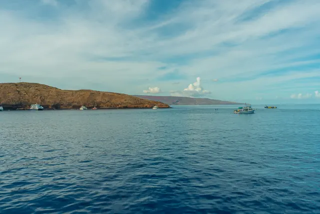
When shore conditions are marginal, a morning boat trip is often the safest way to snorkel. Captains move to sheltered sites such as Coral Gardens if Molokini is rough. See our Molokini tour comparison.
| Tour | Leaves from | Time | Group | From | Book |
|---|---|---|---|---|---|
| Molokini and Turtle Town from KiheiViator: captains choose the calmest site | Kihei | About 3 h | Small boat | $194 | Check availability |
On the beach: a final check
Even with good forecasts, stand on the beach for five minutes before you get in:
- Watch for sets of bigger waves breaking where you plan to enter.
- Look for rip currents: darker, calmer-looking channels where waves are not breaking, often with foam or debris moving out.
- Ask the lifeguard. They know the spot better than any app.
- Plan your exit before you enter.
For more, read our snorkeling safety rules and the full Maui snorkeling guide.